Top-level map: Mercury North Pole Topography
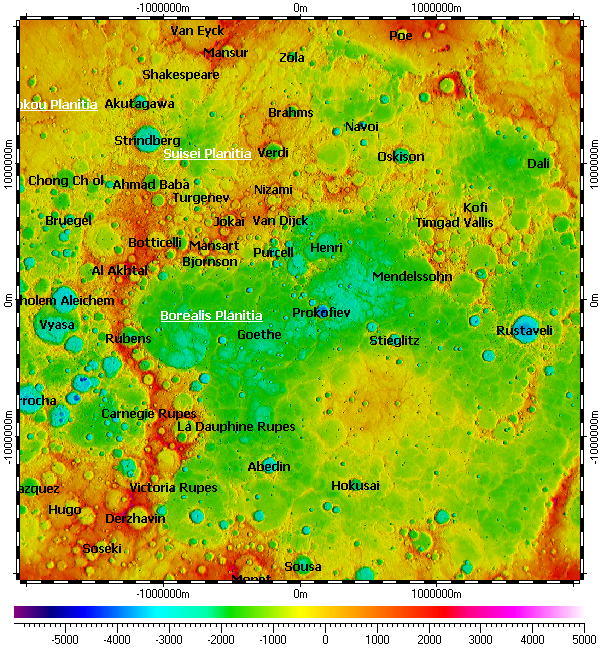
The map uses DEM on its background. The DEM derived from data of Mercury Laser Altimeter (MLA) instrument of MESSENGER mission with resolutions 250m.
Installation prerequisites:
- Installation archive “All vector layers of Mercury”.
- Installation archive “DEM of North Pole of Mercury with resolution 250m”.
- Spatial Aspect Map Locator for installation process.
- Spatial Aspect Explorer for using.
Copyright © 2016-2023 Yuri Feldman - All Rights Reserved