Top-level map: Mars South Pole Nomenclature
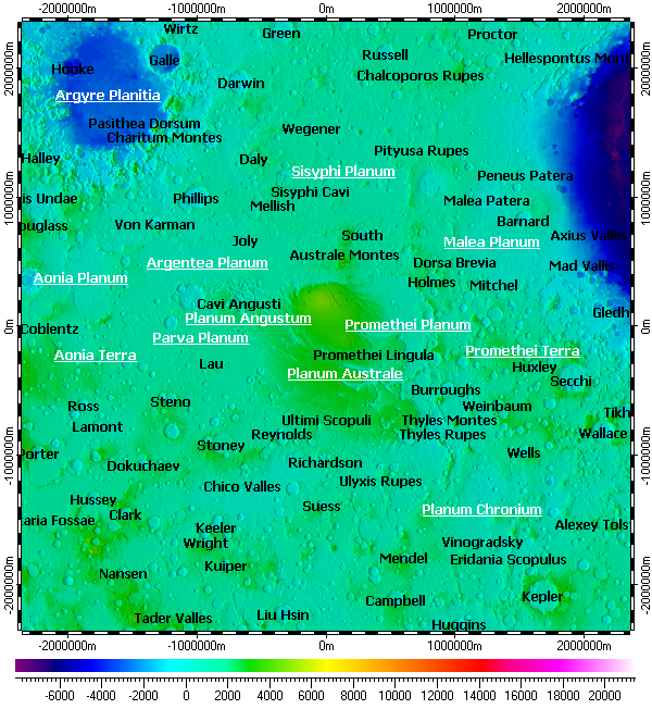
The map uses DEM on its background. The DEM composed from data of Mars Orbiter Laser Altimeter (MOLA) instrument of Mars Global Surveyor (MGS) mission with variable resolution from 460m to 115m.
Installation prerequisites:
- Installation archive “All vector layers of Mars”.
- Installation archive “DEM of South Pole of Mars with multiple resolutions”.
- Spatial Aspect Map Locator for installation process.
- Spatial Aspect Explorer for using.
Copyright © 2016-2023 Yuri Feldman - All Rights Reserved