Archive: DEM of North Pole of Moon with multiple resolutions
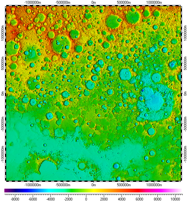
The datum of Digital Elevation Model of North Pole of Moon, included in the archive, derived from raster data of Lunar Orbiter Laser Altimeter (LOLA) experiment, version 2.0, which was part of Lunar Reconnaissance Orbiter (LRO) mission, and distributed by Planetary Data System (PDS) of NASA. The datum has multiple resolutions, utilizing data resolution from 100m to 5m. The data uses Polar Stereographic Projection with true scale latitude of 90°.
The datum presented here generally in form of .ZRS-files (stands Zipped Raster Set), which is proprietary compressed format of author of the datum. Separated files of the datum are in hierarchical and multi-resolution relation for optimization of speed and appearance upon using in Spatial Aspect Viewer and Spatial Aspect Explorer.
Also the datum contents set of spatial regions representing limiting areas for each primary used data of respective resolutions.
Installation prerequisites:
- Spatial Aspect Map Locator for installation process and easy launching.
- Spatial Aspect Viewer or Spatial Aspect Explorer for using.
View license agreement for using the data
Installation set of files:
MoonNorthPole_.zip -
Size: 1,793,078,990 bytes (1.66 GB); MD5: DF2C511CB91342BE9EBE377FDDED7520.
![]()
_MoonNorth34.zip -
Size: 1,216,109,135 bytes (1.13 GB); MD5: 4BDBEF3EE031A9D124ABCD75F62DF1D5.
![]()
Additional instructions:
Files from this set should be kept in a common folder "\North Pole", for example. Only the first file
"MoonNorthPole_.zip" will be selected by user upon installation entire datum from this archive by
using Spatial Aspect Map Locator. See user manual of the program for
more details.
Copyright © 2016-2023 Yuri Feldman - All Rights Reserved