Archive: DEM of North Pole of Mars with multiple resolutions
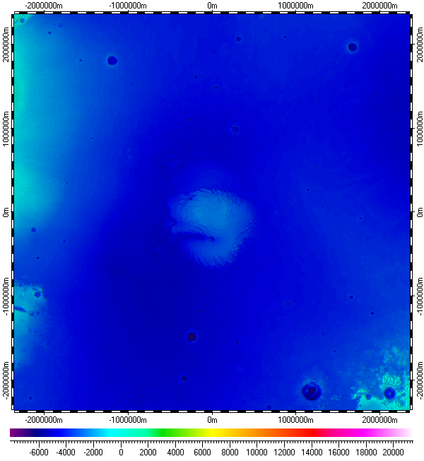
The datum of Digital Elevation Model of North Pole of Mars, included in the archive, derived from raster data of Mars Orbiter Laser Altimeter (MOLA) Mission Experiment, version 1, which was part of Mars Global Surveyor (MGS) mission, and distributed by Planetary Data System (PDS) of NASA. The elevation data is kind of topography over areoid. The datum has multiple resolutions, utilizing data resolution from 460m to 115m. The data uses Polar Stereographic Projection with true scale latitude of 90°.
The datum presented here generally in form of .ZRS-files (stands Zipped Raster Set), which is proprietary compressed format of author of the datum. Separated files of the datum are in hierarchical and multi-resolution relation for optimization of speed and appearance upon using in Spatial Aspect Viewer and Spatial Aspect Explorer.
Also the datum contents sparse set of spatial regions covering main areographical features of North Pole of Mars and also representing limiting areas for each primary used data of respective resolutions.
Installation prerequisites:
- Spatial Aspect Map Locator for installation process and easy launching.
- Spatial Aspect Viewer or Spatial Aspect Explorer for using.
View license agreement for using the data
Installation file:
MarsNorthPole.zip -
Size: 311,644,951 bytes (297 MB); MD5: 40D8385FB1A5956B18DB17C663F5F5A2.
Copyright © 2016-2023 Yuri Feldman - All Rights Reserved