Archive: DEM of Antarctica
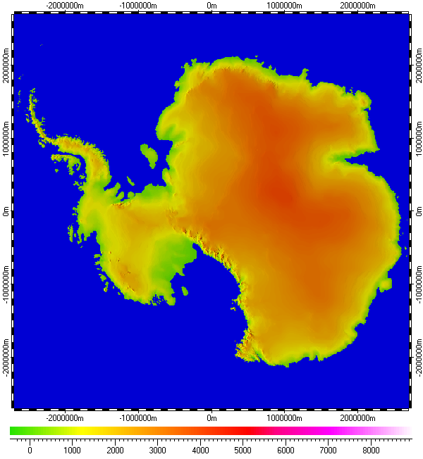
The datum of Digital Elevation Model of Antarctica, included in the archive, derived from raster data of GTOPO30 project, distributed by the USGS EROS data center. Base resolution of the datum is 1km. The data uses Polar Stereographic Projection with true scale latitude of -71°.
The datum presented here generally in form of .ZRS-files (stands Zipped Raster Set), which is proprietary compressed format of author of the datum. Separated files of the datum are in hierarchical and multi-resolution relation for optimization of speed and appearance upon using in Spatial Aspect Viewer and Spatial Aspect Explorer.
Also the datum contents set of spatial regions covering main geographical features of Antarctica, mainly in respect of ocean features and ice shelves.
Installation prerequisites:
- Spatial Aspect Map Locator for installation process and easy launching.
- Spatial Aspect Viewer or Spatial Aspect Explorer for using.
View license agreement for using the data
Installation file:
Antarctica.zip -
Size: 7,398,724 bytes (7.05 MB); MD5: A54766537B8338DE95188834C3CBD9F2.
Copyright © 2016-2023 Yuri Feldman - All Rights Reserved